UK flood impacts from new local 2.2km climate projections

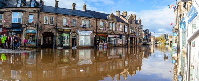
Making more accurate projections of the changing nature of UK flood risk in order to make the correct decisions within climate change mitigation and adaptation, development control, design of resilient infrastructure and flood management.
The challenge
Climate projections at very high (2.2km) resolution have recently become available for the UK from the UKCP project. The new 2.2km climate model provides a step change in the representation of convection – a key process behind many of our extreme weather events – such that it is able to provide credible projections of future changes in weather extremes at local scales. It captures not only changes in mean rainfall, but also changes in the intensity, frequency, temporal clustering and spatial structure of hourly precipitation events, which is critical for understanding future changes in flooding across the UK.
However, there are very few studies that have directly used output from km-scale climate models in hydrological modelling. One of the first – the NERC FUTURE-DRAINAGE project – is using rainfall uplift estimates from UKCP Local (2.2km) for urban drainage modelling, but not the full 2.2km timeseries data.
What we're doing
In this pilot study, for the first time we want to assess how both river and direct surface water flooding vary if we simulate the full hourly rainfall timeseries, compared to the more traditional technique of applying climate change factors (often derived from coarser resolution climate models) to an observed precipitation timeseries.
The UKCP Local (2.2km) data, for the present and future climate, would be used as input into a pluvial inundation model2, focussing on urban catchments; and into a national hydrological model (DECIPHeR3) to model the impact of changing rainfall characteristics on river flows, which then would be fed into a fluvial inundation model, Fathom-UK4, initially for 2-3 contrasting catchments.
How it helps
Future changes in flooding are expected to have significant impacts on both society and natural ecosystems. This pilot study will provide important information as to whether existing approaches used in flood modelling are robust, or whether flood predictions are significantly different when we account for the full changes in the spatial and temporal characteristics of hourly rainfall as provided by the latest high-resolution climate simulations. This pilot study would then inform a future bid to extend the use of state-of-the-art UKCP Local (2.2km) projections for flood modelling across the UK, with the aim of providing new robust estimates of pluvial and fluvial flood risk in a changing climate.
Investigators
- Lizzie Kendon, Faculty of Science and Engineering/Met Office
- Dann Mitchell, Geographical Sciences
- Gemma Coxon, Geographical Sciences
- Jeff Neal, Geographical Sciences
- Simbi Hatchard, PDRA seconded from Fathom
 Lead researcher profile
Dr Lizzie Kendon, Faculty of Science and Met Office
Related research centres
Partner organisations
- FATHOM
- Met Office