Earthquake disasters have many catastrophic effects - loss of life and injury as well as direct physical and financial loss. In the aftermath of an earthquake event, these direct impacts can induce a cascade of indirect losses and distress that trickle down through society.
Understanding the risk, both physically and financially, associated with an earthquake event is a very challenging but necessary component of implementing effective mitigation measures. Decision-support tools, which help put values to the potential losses are critical in managing this risk, yet there is considerable uncertainty associated with the models that form the basis of these tools.
Many of the models used in risk analysis are focused on a single site – they evaluate how a particular structure will stand up in the event of an earthquake. However, earthquakes don’t operate in isolation. Multiple areas, with all the buildings and infrastructure, are simultaneously affected. Understanding how the loss across a number of areas might be correlated during a single earthquake event is critical to evaluating risk.
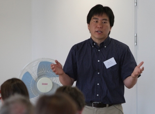
Dr Katsu Goda, a member of the Cabot Institute and Lecturer in the Department of Civil Engineering at the University of Bristol, developed a ground-motion model that can assess multiple areas by shaking whole cities rather than just individual buildings. Goda developed the model while at the University of Western Ontario in Canada and it has already found applications in earthquake insurance portfolio analysis and within the risk modelling and consulting industry.
“I developed a spatial correlation model,” said Goda, “which essentially changes the probability distribution of a seismic loss curve. This means that if a risk management company, such as a bank or insurance company, is managing to a target of a 1-in-1000 year seismic event they might need to be prepared for a $300 million loss rather than the $100 million loss that would be estimated under other models. That’s a significant difference with potentially serious consequences for the financial viability of a company.”
I had the opportunity to go to Tōhoku, Japan after the tsunami. Looking at the damage made me realise that more needed to be done. This is why I’m working toward a multi-hazard seismic assessment, which incorporates the risk associated with earth movements as well as the risk of a tsunami.
Goda has applied his model to hypothetical wood-frame houses in south-western British Columbia, Canada – an area prone to earthquakes – to evaluate what portfolio parameters affect the likelihood of an insurer going bankrupt in the events of both an ordinary and catastrophic earthquake risk: "Canada offers very different tectonic settings within the same country. The west coast, with the cities of Victoria and Vancouver, is prone to shallow crustal earthquakes and sits on the Cascadia subduction zone. It’s in a similar tectonic situation to Japan and New Zealand. However, in the east, near Montreal, the rock is more solid and gives a different kind of attenuation of the ground motion. It’s more similar to the UK.”
Goda has also applied his model to develop a seismic hazard assessment for the UK and to produce a seismic hazard map for a rift region in Africa that has had no previous assessments incorporating geomorphological evidence.
Goda is now turning his attention to tsunamis as he wishes to incorporate this potentially devastating cascade effect of earthquake events into his model.
“I had the opportunity to go to Tōhoku, Japan after the tsunami as part of the Earthquake Engineering Field Investigation Team,” said Goda. “Looking at the damage made me realise that more needed to be done. This is why I’m working toward a multi-hazard seismic assessment, which incorporates the risk associated with earth movements as well as the risk of a tsunami.”
Goda will travel to Kyoto University in March 2013 to develop his tsunami model, after which he hopes to apply the multi-hazard earthquake model to coastal communities of western Canada: “If an earthquake happens in the Cascadia subduction zone, which runs from the north end of Vancouver Island in Canada to northern California in the US, it’s estimated that it could reach a magnitude of 9.0, which is the same as the 2011 Tōhoku earthquake. There’s evidence that a previous earthquake in 1700 triggered a tsunami event and I expect that ground shaking compounded by tsunami damage would have a significant impact on the Canadian Government.”
Key facts:
- Katsu Goda was selected for the 2012 Charles F. Richter Early Career Award, given by the Seismological Society of America (SSA), for his research on probabilistic seismic hazard/risk analysis and catastrophic earthquake risk management.
- The Earthquake Engineering Field Investigation Team is a group of earthquake engineers, architects and academics who collaborate with colleagues in earthquake prone countries to improve the seismic resistance of both traditional and engineered structures.
- The Cabot Institute carries out fundamental and responsive research on living with environmental uncertainty and risk. its interests include natural hazards, resilience and governance, good and energy security, and the changing urban environment. Research fuses rigorous statistical and numerical modelling with a deep understanding of interconnected social, environmental and engineered systems – past, present and future.