The study, published today in Nature and led by researchers at the University of Bristol and UiT The Arctic University of Norway, provides the first dataset showing the thickness of sea ice across the entire Arctic through the whole year.
Lead author Dr Jack Landy, sea ice scientist at UiT and formerly at Bristol, said: "The Arctic ice is melting faster than ever. We need knowledge about the thickness of the sea ice, both to reduce safety risks for businesses and shipping in the Arctic, but also to make forecasts for the future climate."
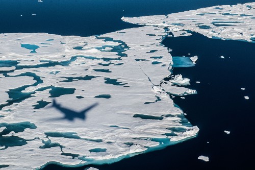
Satellites have been used to measure the thickness of ice in the Arctic since the 1980s. But the technique has only worked in winter, from October to March, when the ice and snow are cold and dry.
"In the summer months the satellites are dazzled by ponds of snow and ice meltwater that pool on the sea ice surface. Then they have been unable to distinguish between melting ice and water," said Dr Landy.
To solve the problem, the researchers adopted Artificial Intelligence (AI) and examined previous data from the satellites. Now they know when the satellites register ice and when they register ocean.
In addition, the team has constructed a new computer model of the satellite sensor to ensure it is measuring the correct height and thickness, which is beneficial for the shipping industry.
Shipping in the Arctic has increased rapidly in recent years, because of the ice melting. Particularly in the Barents Sea and close to Svalbard the shipping activity is high during summer. To sail safely, the boats need information in advance about where there is ice and it thickness.
The Norwegian Meteorological Institute provide sea ice forecasts for the Arctic but have lacked secure ice thickness data for the summer months.
“Using the new satellite data, we are finally able to make sea ice forecasts informed by the ice thickness, not only for the winter, but also for the summer. This will reduce safety risks for ships and fishing boats,” Dr Landy said.
"We can also predict whether there will be ice or not at a given location in September, by measuring the ice thickness in May."
The findings are also of great importance for our understanding of weather and climate, as the new data can be used in advanced climate models to improve forecasts.
Co-author Dr Geoffrey Dawson, Senior Research Associate at the University of Bristol, said: “We can use the new ice thickness data in advanced climate models to improve short-term weather forecasts and our predictions of what climate we will have in years to come.
“This work was only possible because of the excellent data provided by the CryoSat-2 satellite.”
Paper:
'A year-round satellite sea-ice thickness record from CryoSat-2' by Dr Jack C. Landy et al in Nature.