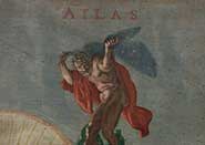
The online exhibition – 'Atlases: Poetics, Politics, and Performance' – showcases 33 atlases housed in the University of Bristol Library’s Special Collections. Spanning the first four hundred years of the history of the atlas, they include the work of mapmakers and organizations from a variety of countries: from the Dutch laboratories of the Blaeu family in the seventeenth century to the United States’ Military Academy during the Cold War; from colonial Africa to revolutionary Cuba.
Dr Mark Jackson of the School of Geographical Sciences said: "In their diversity, these atlases unfold a history, or rather, many parallel histories of visualizing and ‘ordering’ the world – histories underpinned by aesthetic pleasure and power, by a desire to explore, systematize, and comprehend."
Veronica della Dora, lead scholar on the project and historic map specialist in the School of Geographical Sciences, continued: "The history of the atlas is linked to the spread of general education, the development of print culture and the emergence of a consumer culture in the Renaissance West.
"Since its original conception, the atlas has proven one of the most resilient cartographic genres, often transcending geographical learning. Over the centuries, its format has been adopted by anatomists, biologists, geologists, governments, and intelligence services alike as an effective instrument for organizing and showcasing different forms of knowledge."
The exhibition is organized into four thematic sections. Renaissance Theatres features famous and less famous examples dating from the late sixteenth to the mid seventeenth centuries and invites the viewer to reflect on their function as mnemonic devices, objects of poetic contemplation, visual ‘cabinets of curiosities’, and status symbols.
Rhetoric of Truth sets eighteenth and early nineteenth centuries geological and archaeological atlases side by side with early computer-generated examples, stressing modern science’s constant attempt to penetrate beneath the surface and unveil hidden orders.
The Colonial Gaze focuses on atlases used to implement colonial projects, including land exploitation in Africa and in the West Indies, and the circulation of racial theories in late nineteenth-century Europe and North America.
The last section, National Identities and Conflict, explores the role of atlases as powerful instruments for visualizing conflict and for shaping territorial and political imaginations in the twentieth century.
Head of Special Collections Michael Richardson said: "In the age of Google Earth, this exhibition is ultimately meant to stir public interest in the history of the atlas and of cartography in general, offering an accessible and dynamic resource for teaching, research, and, not least, virtual exploration."
