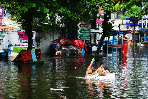
Their insights could help people and governments better protect themselves against risk and flood losses.
As reported in Nature Communications today (Thursday 18 April), experts in flood risk and environmental uncertainty analysed detailed hazard maps of 18 countries across Latin America, Asia and Africa against data developed by Facebook’s Connectivity Labs detailing population density in those countries.
Previous studies have relied on global population data sets that suggest people settle on flood prone river floodplains. The specificity of the data set used in this study – based on satellite images at a resolution of 1.6 metres that detected every single building in the area – revealed that this is not the case.
Whereas ordinary population data sets assume that people are spread across the landscape, this study accounted for the fact that people live in buildings and urban areas by allocating the total population count only amongst the identified buildings.
By then counting all the people living in each modelled area, and intersecting this against their flood hazard data, researchers were able to improve their estimates of the numbers of people at risk from floods in these countries.
Co-author Professor Paul Bates from the University of Bristol’s School of Geographical Sciences and Cabot Institute said: “Until now, the science community has tended to focus more on the frequency and nature of flood hazards themselves than on the location of people affected and the impact that hazards have on them. The exciting thing about this study is that it shows how new satellite data sets can be used to transform our understanding of flood risk in some of the most vulnerable countries worldwide.”
While previous studies have looked at the human impact of floods, the results are likely to be based on miscalculated estimates of flood risk.
“If either the hazard map or the population map is wrong, then you get poor results,” adds Professor Bates. “Up until now all the sources of population data had significant problems, and if we use much more realistic information, we get very different answers.”
Since 2015, Bristol researchers have been able to model flood inundation (the degree and frequency of flooding) to a resolution of 90m across the whole planet, providing an 85% match between observed maps of flooding and their computer models.
By applying these techniques, researchers have now shown the real risks faced by countries like Malawi. According to previous datasets, about 80% of floodplain areas here were estimated to be populated. Using the new data this reduces to only 2%. However, in this 2% of floodplain areas the population densities are shown to be much higher, so if these areas do get inundated then the damage caused and the threat to life will be significantly greater.
As with the other countries studied, this data paints a more accurate picture of where flood defences and flood warnings are most urgently needed, meaning that limited resources can be directed to the places with highest need. It will also give insurers the confidence they require to offer cover because they will better understand the risk.